
It can be understood that some trailers are undergoing improvements on their design, some of us believe that the olive oil in trailers 5 & 13 are 2 variants of the same one.
[ external image ]
Here's some tips to improve Huerta del Mar Menor logo in case you were thinking of updating it. But first, a map.
[ external image ]
DEFINITION
==========
MAR MENOR is Europe's largest saltwater lagoon (it's not a lake, even though it's smaller than Venice, it's got much more water), it is connected to the Mediterranean sea by 5 canals that split La Manga del Mar Menor. https://en.wikipedia.org/wiki/Mar_Menor
LA MANGA: https://marmenormarmayor.es/mar-menor/la-manga.html
HUERTA, CAMPO & VEGA
=====================
I'm a local, but never thought of Mar Menor as a HUERTA, instead we learnt in schools it was a CAMPO (Campo de Cartagena y del Mar Menor). I'm OK with your choice of words anyway, you can say that nowadays there is a big HUERTA in CAMPO DE CARTAGENA and MAR MENOR thanks to modern irrigation techniques and water transfers from Tagus river (not EBRO though, northeners wouldn't let us their water because they claimed it would all go to water golf courses, which isn't entirely false).
HUERTA: irrigation farming (intensive)
CAMPO: dry lands (extensive)
VEGA: fertile land next to a river
A HUERTA requires a great supply of water, traditionally, old HUERTAS are found next to a river, that fertile area near a river is called VEGA, a VEGA will be split in terms of the river course, VEGA ALTA, VEGA MEDIA, VEGA BAJA (high, mid, low). The city of LAS VEGAS was named after all the irrigation received by the COLORADO RIVER before the construction of the HOOVER DAM. This recent conversion from CAMPO to HUERTA has damaged MAR MENOR, there is a big enviromental debate around the techniques used by farmers and what's the price of prosperity at such short sight for other community elements (tourism, nature and inhabitants). The term VEGA is widely used IRL to define areas of influence (vega alta, vega media, vega baja...) in many rivers of Spain. BTW VEGA BAJA of SEGURA RIVER is in ALICANTE province (that's why it does not appear in the map).
LANDMARKS OF MAR MENOR
========================
I see some rolling hills on the logo, but there aren't any IRL. The terrain is actually pretty flat. There are mountains surrounding the whole place to the north, west and south. If you want to use mountains for the logo, there are some volcanic cones (cabezos) from Sierra de la Muela to Mar Menor, the biggest isolated mountains are CABEZO GORDO, EL CARMOLÍ & the isles.
[ external image ]
CABEZO GORDO (can't really tell if you already used it for the logo)
[ external image ]
[ external image ]
[ external image ]
[ external image ]
[ external image ]
[ external image ]
EL CARMOLÍ is a much smaller mountain (a volcano in fact).
[ external image ]
[ external image ]
ISLA GROSA (big island in Old Spanish)
[ external image ]
[ external image ]
MAR MENOR ISLANDS
[ external image ]
[ external image ]
[ external image ]
[ external image ]
[ external image ]
SYMBOLS OF THE AREA
====================
SEA HORSE (CABALLITO DEL MAR MENOR)
[ external image ]
The WINDMILLS (from the CAMPO (PRE-HUERTA) ERA)
[ external image ]
[ external image ]
The centre for road conservation of the area is built around a former WINDMILL
https://www.google.com/maps/@37.6521548 ... 312!8i6656
[ external image ]
LA MANGA DEL MAR MENOR (22km of isthmus)
[ external image ]
[ external image ]
CABO DE PALOS LIGHTHOUSE
[ external image ]
FLAMINGOES, MIGRANT BIRDS AND SALINAS (salt yards)
[ external image ]
[ external image ]
[ external image ]
[ external image ]
Spain pre-research tips
Cartagena Revision
With @Madel 's permission, I'm gonna update his contribution's on Cartagena with some pictures I've taken today. Just in case it appears in the game, it would be a sorrowful loss if not 
Every picture I took is included in a DROPBOX folder at your disposal, if you clic each image on a new tab you'll get them full size. There are also other pictures with details, views, boards and such.
https://www.dropbox.com/sh/ppkd3opp9njn ... a71Pa?dl=0
[ external image ]
This is from N-332
[ external image ]
This are the views from N-332 to the port.
[ external image ]
Views from the fishermen port area, there are a few sculptures in the area: a plane from Patrulla Águila in the University Wall, a fishing boat and a rocky igloo (water storage).
https://www.google.es/maps/@37.5993195, ... 312!8i6656
Bus Station
[ external image ]
CT-33 & Port
===========
A port is not a port without the sound of seaguls, the sporadic horn of ships and the bell of some machine ringing out there at times. Hopefully you've got that covered from the sound recording trip.
The road CT-33 to the port has changed a bit, here's a small park here https://www.google.es/maps/@37.5993073, ... a=!3m1!1e3
There's also this huge wall painting of the Cartagena symbols (minery, fishing, icues carrying the city flag, the port and the windmill) and some historical characters in a warehouse by the roundabout access to the port.
[ external image ]
[ external image ]
[ external image ]
[ external image ]
You can read some cropped letters from the metal cross, from West to East and from South to North WELCOME, THREE THOUSAND YEARS OF HISTORY. There's also a BIENVENIDOS on top from East to West.
BIENVENIDOS
(port logo, a trirreme)
TRES MIL AÑOS
DE HISTORIA
Logo
[ external image ]
[ external image ]
There's also the same technique used for the 5 names of the city.
[ external image ]
Port entrance, there are 2 commercial docks and a military one, Santa Lucía (to the north) & San Pedro (center) and La Curra (military, to the west). The containers are mostly in Santa Lucía, in San Pedro there are storehouses and some containers.
[ external image ]
[ external image ]
Right wall, entrance
[ external image ]
Left wall, entrance
[ external image ]
Port exit
[ external image ]
Warehouse in San Pedro dock
[ external image ]
https://www.google.es/maps/dir/37.59460 ... m2!4m1!3e0
This route is very scenic and spectacular, you get to see the whole bay & the city seafront, drive over a cliff, see the copes & anchored gianormous ships, drive next to old fortifications below and above, there are 3 tunnels with access signals, and the industrial area is crammed between mountains in a dry valley, when you enter you have got the mountain to your left, the industry below and the sea next to it.
[ external image ]
[ external image ]
[ external image ]
[ external image ]
[ external image ]
[ external image ]
[ external image ]
https://www.google.es/maps/@37.5704751, ... a=!3m1!1e3
[ external image ]
Every picture I took is included in a DROPBOX folder at your disposal, if you clic each image on a new tab you'll get them full size. There are also other pictures with details, views, boards and such.
https://www.dropbox.com/sh/ppkd3opp9njn ... a71Pa?dl=0
City entrances, N-332 takes you to the old entrance, old buildings, some parks and the port in this area. Cool wall paintings as well. To the north of N-322 there is A-30 viaduct, the regular train station and some badlands (industrial waste lands, that's why they dont't urbanise there and A-30 is on a viaduct).
[ external image ]
This is from N-332
[ external image ]
This are the views from N-332 to the port.
[ external image ]
Views from the fishermen port area, there are a few sculptures in the area: a plane from Patrulla Águila in the University Wall, a fishing boat and a rocky igloo (water storage).
https://www.google.es/maps/@37.5993195, ... 312!8i6656
Bus Station
[ external image ]
CT-33 & Port
===========
A port is not a port without the sound of seaguls, the sporadic horn of ships and the bell of some machine ringing out there at times. Hopefully you've got that covered from the sound recording trip.
The road CT-33 to the port has changed a bit, here's a small park here https://www.google.es/maps/@37.5993073, ... a=!3m1!1e3
There's also this huge wall painting of the Cartagena symbols (minery, fishing, icues carrying the city flag, the port and the windmill) and some historical characters in a warehouse by the roundabout access to the port.
[ external image ]
[ external image ]
[ external image ]
This roundabout has been rebuilt this year.Madel wrote: ↑07 Dec 2019 15:42 And the roundabout just before enter a the cargo port with this crane ("Grúa Sanson")(CT-33).
Location: https://www.google.es/maps/place/Grua+S ... -0.9697285
[ external image ]
You can read some cropped letters from the metal cross, from West to East and from South to North WELCOME, THREE THOUSAND YEARS OF HISTORY. There's also a BIENVENIDOS on top from East to West.
BIENVENIDOS
(port logo, a trirreme)
TRES MIL AÑOS
DE HISTORIA
Logo
[ external image ]
[ external image ]
There's also the same technique used for the 5 names of the city.
[ external image ]
Port entrance, there are 2 commercial docks and a military one, Santa Lucía (to the north) & San Pedro (center) and La Curra (military, to the west). The containers are mostly in Santa Lucía, in San Pedro there are storehouses and some containers.
[ external image ]
[ external image ]
Right wall, entrance
[ external image ]
Left wall, entrance
[ external image ]
Port exit
[ external image ]
Warehouse in San Pedro dock
[ external image ]
There's a route that connects both ports, the container port and the industrial port.Madel wrote: ↑07 Dec 2019 15:42 And the refinery. Route from A-30 and CT-34 (https://www.google.es/maps/dir/37.62989 ... m2!4m1!3e0).
Location: https://www.google.es/maps/place/Refine ... d-0.923557
https://www.google.es/maps/dir/37.59460 ... m2!4m1!3e0
This route is very scenic and spectacular, you get to see the whole bay & the city seafront, drive over a cliff, see the copes & anchored gianormous ships, drive next to old fortifications below and above, there are 3 tunnels with access signals, and the industrial area is crammed between mountains in a dry valley, when you enter you have got the mountain to your left, the industry below and the sea next to it.
[ external image ]
[ external image ]
[ external image ]
[ external image ]
[ external image ]
[ external image ]
[ external image ]
https://www.google.es/maps/@37.5704751, ... a=!3m1!1e3
[ external image ]
Cartagena Revision II & Other Stuff
Here's probably my last contribution to this thread, I won't add anything else unless I wanted to make a point about something being published. As for this topic, I've been waiting the whole month of December for the workers to finish their job in the port roundabout, it wasn't until early this week that they inaugurated the whole place, I visited the city yesterday so here's some ground research to things you may not get on google earth/maps. There's also some other info I would like to share with you, just in case you may find it useful.
========
Contents
========
1. New port roundabout
2. Mills
3. Palm trees
4. Other details
1. New port roundabout
====================
The port roundabout was nice enough before, however it seems the new local government had to do something to differenciate itself from the previous political party (more on "MC" ahead). There's something unique about Cartagena's local government, there's a coallition of socialists (ex-socialists, this deal got them expelled from the party) and conservatives, something you don't really see in a medium to big city in this country, the alternative was MC, a localist group but nation-wide notoriously known for insulting their opponents.
This is what the roundabout used to look like:
https://www.google.es/maps/@37.594758,- ... a=!3m1!1e3
Now they added the 5 city names (see post above), a cross monolith, red&yellow flowers and some small plants. They installed LED so you may find it in different colours, although I believe that the red & green scheme will only be present for Christmas.
[ external image ]
[ external image ]
[ external image ]
[ external image ]
This stand is facing the port entrance:
[ external image ]
[ external image ]
[ external image ]
[ external image ]
As you can see they installed lights behind the city names, it creates a jack-o-lantern effect. During the day it's also curious depending on the sunrays source:
[ external image ]
[ external image ]
[ external image ]
2. Mills
======
Mills to grind cereal, they were eventually abandoned some decades ago for there were better paid jobs at the factories. They have restored this one in N-332
https://www.google.es/maps/@37.6049707, ... a=!3m1!1e3
Now it looks like this:
[ external image ]
[ external image ]
[ external image ]
There's plenty of old and ruiny mills, they're slowly restaurating all of them, but it takes time and nowadays all you'll probably only see are broken down mills. They can be found usually near a finca (farm), surrounded by some canarian palm trees and pinus halepensis. This is a very characteristic sight of Campo de Cartagena, they could be counted by hundreds.
[ external image ]
[ external image ]
[ external image ]
[ external image ]
3. Palm trees
===========
Old farms will probably have PHOENIX DACTYLIFERA, but in cities they planted PHOENIX CANARIENSIS (Canarian Palm tree) which is very similar but better looking (thicker, greener leaves and taller but with bitter dates). Sometimes they plant them 2 or 3 very close to each other. Dactylifera comes from the Fertile Crescent (Egypt to Irak) while Canariensis come from Spain (Canary Islands).
[ external image ]
[ external image ]
Another palm tree that has been reportedly naturalized in Spain is WASHINGTONIA ROBUSTA (from southwest US). This plant will be planted along the PHOENIX CANARIENSIS (Canarian Palm Tree) in most parks, but thanks to its autonomy and fast growth, it's planted in places where it can't be taken care of. You shall find this plant in 3 variants:
Untrimmed
[ external image ]
Pruned dead leaves (except the ones close to the tree top)
[ external image ]
Trunk peeled or partially peeled
[ external image ]
[ external image ]
Another palm trees that you may find are CHAMAEROPS HUMILIS (PALMITO or MIDGET PALM, originary from Spain)
[ external image ]
4. Other details
==============
Puerto de Culturas is the local entity that nurses the touristic areas of the city, they've decorated most of the port area with wall paintings (see post above, there's 2 paintings that do not appear on Google Maps):
[ external image ]
[ external image ]
Some other distinctive features of the port area are:
Portworks ship:
https://www.google.es/maps/@37.6000534, ... 312!8i6656
[ external image ]
Dome (water storage):
https://www.google.es/maps/@37.5998106, ... 312!8i6656
[ external image ]
N-332 entry to the city, below Despeñaperros castle
https://www.google.es/maps/@37.6035331, ... 312!8i6656
[ external image ]
C-101, Spanish Air Force exhibition plane, over the University wall.
https://www.google.es/maps/@37.6007691, ... 312!8i6656
[ external image ]
There's another one like it in N-332 in a roundabout in the city of San Javier
https://www.google.es/maps/@37.8222883, ... a=!3m1!1e3
A-30 : road works building decoration:
https://www.google.es/maps/@37.9575467, ... 312!8i6656
[ external image ]
A-30: the best beer garden in Murcia:
https://www.google.es/maps/@37.9563125, ... 312!8i6656
[ external image ]
A-30 Horses
https://www.google.es/maps/@37.7509149, ... 312!8i6656
[ external image ]
A-30 Ship stern
https://www.google.es/maps/@37.7592025, ... 312!8i6656
[ external image ]
A-30 H2O with pebbles (notice that in Google Earth it appears Vota MC, the guys who are no longer in power)
https://earth.google.com/web/@37.612834 ... 962177t,0r
[ external image ]
N-332 salinas (salt fields). Mar Menor has many of these salinas north and south, the ones in Alicante are specially large. Honour mention to the pink lagoon of Torrevieja.
https://www.google.es/maps/@38.183411,- ... a=!3m1!1e3
[ external image ]
Info links:
========
https://www.laverdad.es/murcia/cartagen ... ntvo.html
Happy New Year!
EDIT:
I forgot to add these to the PALM TREES section:
I guess trees are going to be a thing to haul (olive trees have been seen in some screenshots). Palm tree nurseries are very importanto in southeast Spain, especially between the cities of Elche & Orihuela, check this map looking for palm trees nurseries:
https://www.google.com/search?[url]tbs= ... hd:;si:;mv:[[45.128263363041405,13.346710033815485],[32.593760110841714,-15.767059497434493],null,[39.13913529998139,-1.2101747318094946],6][/url]
http://viverosalbatera.com/
These places look like tiny jungles from the road, they may be under 1 sq km, but they look great.
PALM TREE TRANSPORT
[ external image ]
[ external image ]
Another very successful plant in this southeast area is PHRAGMITES, some of them are invasive, others are native (can't remember which is which though)
[ external image ]
[ external image ]
========
Contents
========
1. New port roundabout
2. Mills
3. Palm trees
4. Other details
1. New port roundabout
====================
The port roundabout was nice enough before, however it seems the new local government had to do something to differenciate itself from the previous political party (more on "MC" ahead). There's something unique about Cartagena's local government, there's a coallition of socialists (ex-socialists, this deal got them expelled from the party) and conservatives, something you don't really see in a medium to big city in this country, the alternative was MC, a localist group but nation-wide notoriously known for insulting their opponents.
This is what the roundabout used to look like:
https://www.google.es/maps/@37.594758,- ... a=!3m1!1e3
Now they added the 5 city names (see post above), a cross monolith, red&yellow flowers and some small plants. They installed LED so you may find it in different colours, although I believe that the red & green scheme will only be present for Christmas.
[ external image ]
[ external image ]
[ external image ]
[ external image ]
This stand is facing the port entrance:
[ external image ]
[ external image ]
[ external image ]
[ external image ]
As you can see they installed lights behind the city names, it creates a jack-o-lantern effect. During the day it's also curious depending on the sunrays source:
[ external image ]
[ external image ]
[ external image ]
2. Mills
======
Mills to grind cereal, they were eventually abandoned some decades ago for there were better paid jobs at the factories. They have restored this one in N-332
https://www.google.es/maps/@37.6049707, ... a=!3m1!1e3
Now it looks like this:
[ external image ]
[ external image ]
[ external image ]
There's plenty of old and ruiny mills, they're slowly restaurating all of them, but it takes time and nowadays all you'll probably only see are broken down mills. They can be found usually near a finca (farm), surrounded by some canarian palm trees and pinus halepensis. This is a very characteristic sight of Campo de Cartagena, they could be counted by hundreds.
[ external image ]
[ external image ]
[ external image ]
[ external image ]
3. Palm trees
===========
Old farms will probably have PHOENIX DACTYLIFERA, but in cities they planted PHOENIX CANARIENSIS (Canarian Palm tree) which is very similar but better looking (thicker, greener leaves and taller but with bitter dates). Sometimes they plant them 2 or 3 very close to each other. Dactylifera comes from the Fertile Crescent (Egypt to Irak) while Canariensis come from Spain (Canary Islands).
[ external image ]
[ external image ]
Another palm tree that has been reportedly naturalized in Spain is WASHINGTONIA ROBUSTA (from southwest US). This plant will be planted along the PHOENIX CANARIENSIS (Canarian Palm Tree) in most parks, but thanks to its autonomy and fast growth, it's planted in places where it can't be taken care of. You shall find this plant in 3 variants:
Untrimmed
[ external image ]
Pruned dead leaves (except the ones close to the tree top)
[ external image ]
Trunk peeled or partially peeled
[ external image ]
[ external image ]
Another palm trees that you may find are CHAMAEROPS HUMILIS (PALMITO or MIDGET PALM, originary from Spain)
[ external image ]
4. Other details
==============
Puerto de Culturas is the local entity that nurses the touristic areas of the city, they've decorated most of the port area with wall paintings (see post above, there's 2 paintings that do not appear on Google Maps):
[ external image ]
[ external image ]
Some other distinctive features of the port area are:
Portworks ship:
https://www.google.es/maps/@37.6000534, ... 312!8i6656
[ external image ]
Dome (water storage):
https://www.google.es/maps/@37.5998106, ... 312!8i6656
[ external image ]
N-332 entry to the city, below Despeñaperros castle
https://www.google.es/maps/@37.6035331, ... 312!8i6656
[ external image ]
C-101, Spanish Air Force exhibition plane, over the University wall.
https://www.google.es/maps/@37.6007691, ... 312!8i6656
[ external image ]
There's another one like it in N-332 in a roundabout in the city of San Javier
https://www.google.es/maps/@37.8222883, ... a=!3m1!1e3
A-30 : road works building decoration:
https://www.google.es/maps/@37.9575467, ... 312!8i6656
[ external image ]
A-30: the best beer garden in Murcia:
https://www.google.es/maps/@37.9563125, ... 312!8i6656
[ external image ]
A-30 Horses
https://www.google.es/maps/@37.7509149, ... 312!8i6656
[ external image ]
A-30 Ship stern
https://www.google.es/maps/@37.7592025, ... 312!8i6656
[ external image ]
A-30 H2O with pebbles (notice that in Google Earth it appears Vota MC, the guys who are no longer in power)
https://earth.google.com/web/@37.612834 ... 962177t,0r
[ external image ]
N-332 salinas (salt fields). Mar Menor has many of these salinas north and south, the ones in Alicante are specially large. Honour mention to the pink lagoon of Torrevieja.
https://www.google.es/maps/@38.183411,- ... a=!3m1!1e3
[ external image ]
Info links:
========
https://www.laverdad.es/murcia/cartagen ... ntvo.html
Happy New Year!
EDIT:
I forgot to add these to the PALM TREES section:
I guess trees are going to be a thing to haul (olive trees have been seen in some screenshots). Palm tree nurseries are very importanto in southeast Spain, especially between the cities of Elche & Orihuela, check this map looking for palm trees nurseries:
https://www.google.com/search?[url]tbs= ... hd:;si:;mv:[[45.128263363041405,13.346710033815485],[32.593760110841714,-15.767059497434493],null,[39.13913529998139,-1.2101747318094946],6][/url]
http://viverosalbatera.com/
These places look like tiny jungles from the road, they may be under 1 sq km, but they look great.
PALM TREE TRANSPORT
[ external image ]
[ external image ]
Another very successful plant in this southeast area is PHRAGMITES, some of them are invasive, others are native (can't remember which is which though)
[ external image ]
[ external image ]

Re: Spain pre-research tips
Just a reminder. Regarding again with the tolls, this year (September) the AP-2 (Zaragoza/Barcelona) and the AP-7 (La Jonquera/Tarragona) will be free-toll roads.
Blue roads.
[ external image ]
Blue roads.
[ external image ]
AP-7 is not A-7, it's a different road
Hi, I've spotted some noticeable inaccuracies on the last gameplay video of Iberia at https://www.youtube.com/watch?v=5ibzQRyrVxM and a couple of screenshots (which I didn't give any importance at the time).
9:21 it says the road is named AP-7 but it should be A-7 instead (both roads are separated by almost 40 km at that point).
10:04 It says that the route to Cartagena is A-30 (correct) & E-15 (wrong). E-15 designates both A-7 & AP-7. A-30 hasn't got consideration of European route. On the other hand, A-3 and A-31 do have it, they're E-901 & E-903 respectively.
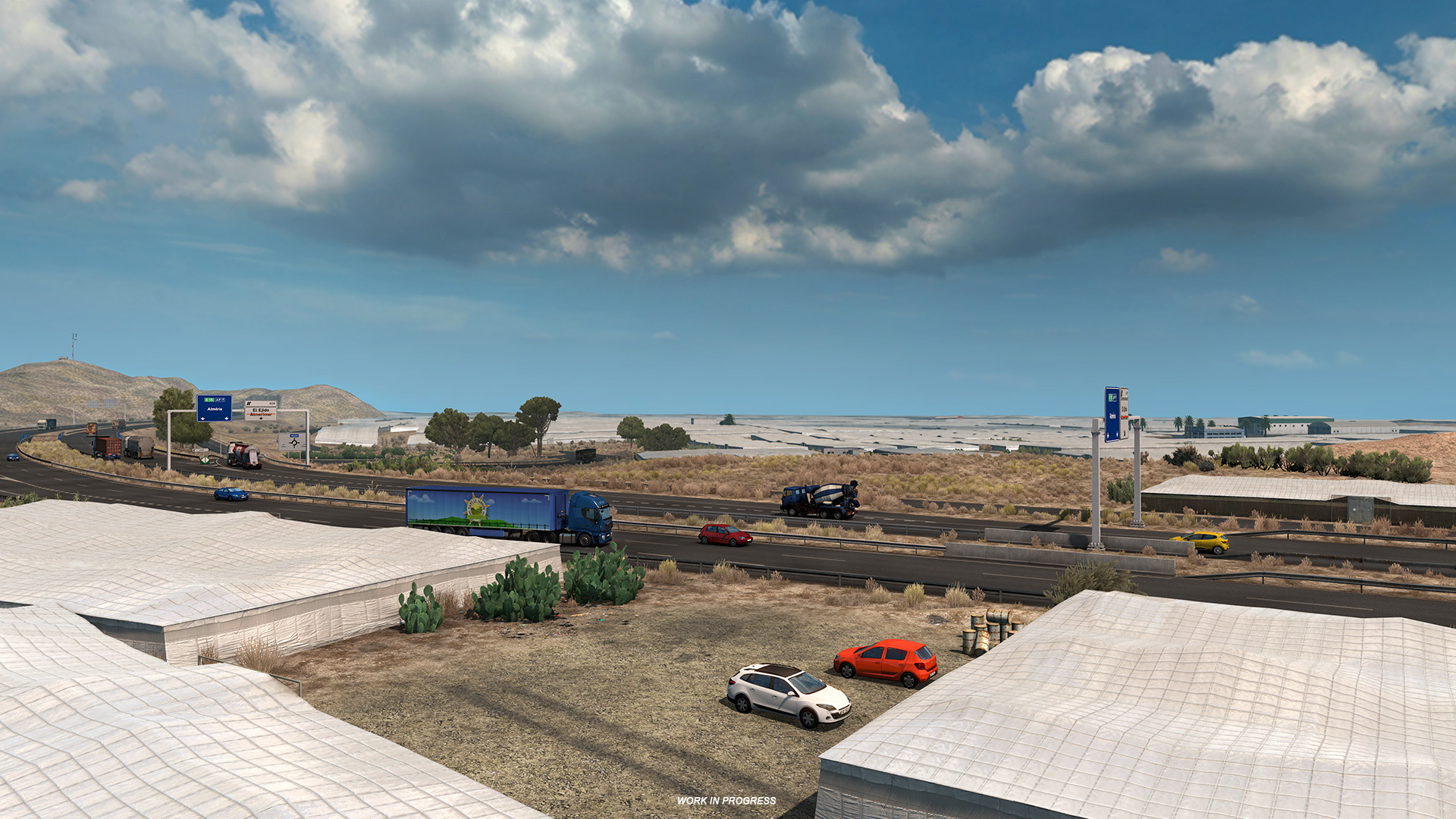
I've also happened to see in screenshots that the road boards between Almería city & El Ejido naming the road as AP-7, that's wrong too. There's only a short stretch of AP-7 in Almería province, it's the one between the cities of Vera & Cartagena.
That's all, thanks for your attention")
References:
A-7
[ external image ]
AP-7
[ external image ]
https://en.wikipedia.org/wiki/Autov%C3%ADa_A-7
https://en.wikipedia.org/wiki/Autopista_AP-7
https://en.wikipedia.org/wiki/Autov%C3%ADa_A-30
https://1.bp.blogspot.com/-ut7wUo_WsQA/ ... 20/10e.jpg
9:21 it says the road is named AP-7 but it should be A-7 instead (both roads are separated by almost 40 km at that point).
10:04 It says that the route to Cartagena is A-30 (correct) & E-15 (wrong). E-15 designates both A-7 & AP-7. A-30 hasn't got consideration of European route. On the other hand, A-3 and A-31 do have it, they're E-901 & E-903 respectively.
I've also happened to see in screenshots that the road boards between Almería city & El Ejido naming the road as AP-7, that's wrong too. There's only a short stretch of AP-7 in Almería province, it's the one between the cities of Vera & Cartagena.
That's all, thanks for your attention
References:
A-7
[ external image ]
AP-7
[ external image ]
https://en.wikipedia.org/wiki/Autov%C3%ADa_A-7
https://en.wikipedia.org/wiki/Autopista_AP-7
https://en.wikipedia.org/wiki/Autov%C3%ADa_A-30
https://1.bp.blogspot.com/-ut7wUo_WsQA/ ... 20/10e.jpg
Confluent roads with A-7 & DGT radars & electronic boards map
I've been driving a bit on A-7 this weekend between Murcia & Alicante and realised that maybe the fact that AP-7 & A-7 converge in a few points may be a bit confusing for a non-local. When they coincide normally (please check, do not take this for granted) the road takes the name A-7 (if it's toll-free). Here's some extra info on that:
AP-7 & A-7: 36 km convergence segment between Alicante & Elche:
https://www.google.com/maps/dir/38.4284 ... m2!4m1!3e0
A-7 & A-30: 3 km convergence segment north of Murcia (those 3 km are the only time A-30 & E-15 coincide). BTW, the road taken to the industrial area of the Murcia video is N-301 (N-301a probably).
https://www.google.com/maps/dir/38.0304 ... m2!4m1!3e0
A-7 & AP-7 around Valencia: 30 km from Valencia to Sagunto.
https://www.google.com/maps/dir/39.7013 ... m2!4m1!3e0
A-7 & AP-7 between Algeciras & Málaga, this is just a short segment (3km) and I think it got chopped off in the 1:19 reduction, but I'll post it anyway.
https://www.google.com/maps/dir/36.4357 ... m2!4m1!3e0
==============================================================
If you visist the DGT website you can search for all the stationary radars and electronic boards on any given road, but you need to zoom it a bit for them to appear, check this link that has selected those 2 elements and discarded any other road incident. This is how it looks checking only "Paneles" & "Radares".
http://infocar.dgt.es/etraffic/Buscador ... car=Buscar
[ external image ]
-
jesuspablo8
- Posts: 2
- Joined: 01 Mar 2021 20:01
Re: Spain pre-research tips
Good morning already in this month of March 2021 DLC IBERIA comes out and I pass you photos of the MAP OF SPAIN.
download/file.php?mode=view&id=38785.
download/file.php?mode=view&id=38786.
download/file.php?mode=view&id=38785.
download/file.php?mode=view&id=38786.
Almería typo
Just in case, Almería has the accent mark over the i. It's not Alméria.
[ external image ]
It's Almería /al.meh'ree.ah/, with the stress on the "i".
[ external image ]
It's Almería /al.meh'ree.ah/, with the stress on the "i".
-
dsf.fernando

- Posts: 585
- Joined: 15 May 2017 09:16
- Location: Leiria, Portugal
- Contact:
Re: Spain pre-research tips
Also, shouldn't Logística Atlântica be named "Logística Atlántica" in Spain, since, as far as i know, ^ (the circumflex) isn't used in modern Spanish?
Proud student of Games and Multimedia in the Polytechnic of Leiria - the Portuguese capital of game development
(and still hopeful the city will feature in the game with a garage someday)
(and still hopeful the city will feature in the game with a garage someday)

Re: Spain pre-research tips
@dsf.fernando exactly, you are right. This is something to report because apparently nobody at SCS has any knowledge of Spanish/Portuguese.
Also please guys why did you call Sagunto "puerto de Sagunto" ? Shouldnt be called just Sagunto? It is also a city.
It would be the same logic as calling Algeciras "puerto de Algeciras" but you didn't do this (fortunately)
Edit 2: gosh, getting older Puerto de Sagunto exists as an independent town as Sagunto, my bad.
Also please guys why did you call Sagunto "puerto de Sagunto" ? Shouldnt be called just Sagunto? It is also a city.
It would be the same logic as calling Algeciras "puerto de Algeciras" but you didn't do this (fortunately)
Edit 2: gosh, getting older
Last edited by LAFAYET47 on 12 Mar 2021 09:08, edited 2 times in total.
Who is online
Users browsing this forum: No registered users and 5 guests